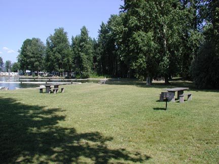
Nine recreation areas are administered by the Corps of Engineers, including four developed campgrounds/day-use areas, two day-use only areas, and three primitive access areas. Albeni Cove, Priest River, Riley Creek, and Springy Point have developed campsites (no hookups, except at Riley Creek) with a variety of day-use facilities. The Visitor Center and Trestle Creek are day-use areas only. Morton Slough, Johnson Creek and the Driftyard (managed by the Idaho Department of Fish and Game) offer primitive camping and boat launch facilities.
Collapse All Expand All

 Albeni Cove
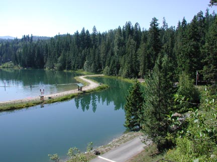
The Albeni Cove Recreation Area is located directly across the Pend Oreille River from the Albeni Falls Dam. From Highway 2, turn south onto Highway 41 at Newport, WA. Follow for 1/2 mile and turn east on Fourth Street into Oldtown, ID. Follow a paved then gravel road for approximately three miles. Coming from Highway 41 south, turn right onto Nagle Road, turn right on Albeni Cove Road and follow the gravel road for approximately two miles.
|
Facilities
|
Comments
|
| Open Dates |
- May 18 - September 14 2024
|
|
Campsites
|
-
All campsites are 100% reservable and available for same-day reservations
-
Ten gravel RV/tent sites with picnic tables and fire rings (one with electricity)
-
Four gravel walk-in tent sites with picnic tables and fire rings
-
No hookups
-
Sleeping limit of eight people per site
|
|
Fees Charged
|
|
|
Picnic Area
|
- Tables and fire pits available
|
|
Swim Area
|
- Designated beach (No lifeguard on duty)
|
|
Boat Ramp
|
- One-lane ramp with fixed pier
|
|
Restroom
|
- Flush Toilets
- Showers (for registered campers only)
- Sinks
|
|
Dump Station
|
|
|
Drinking Water
|
|
|
Roads and Parking
|
- Paved and gravel. Limited car and boat trailer parking
- Only two vehicles are allowed per campsite
|
|
Notes
|
-
Check-out time is at 12:00 p.m. on the day of departure
-
Campground reservations may be made through Recreation One Stop by calling 1-877-444-6777. If you are calling from outside the United States, call 1-518-885-3639. Reservations may also be made online at www.recreation.gov
|
Click here for a printable map of the camppground
Operated by: U.S. Army Corps of Engineers, Albeni Falls Dam, 2376 E. Highway 2, Oldtown, ID 83822, 208-437-3133
|
Driftyard
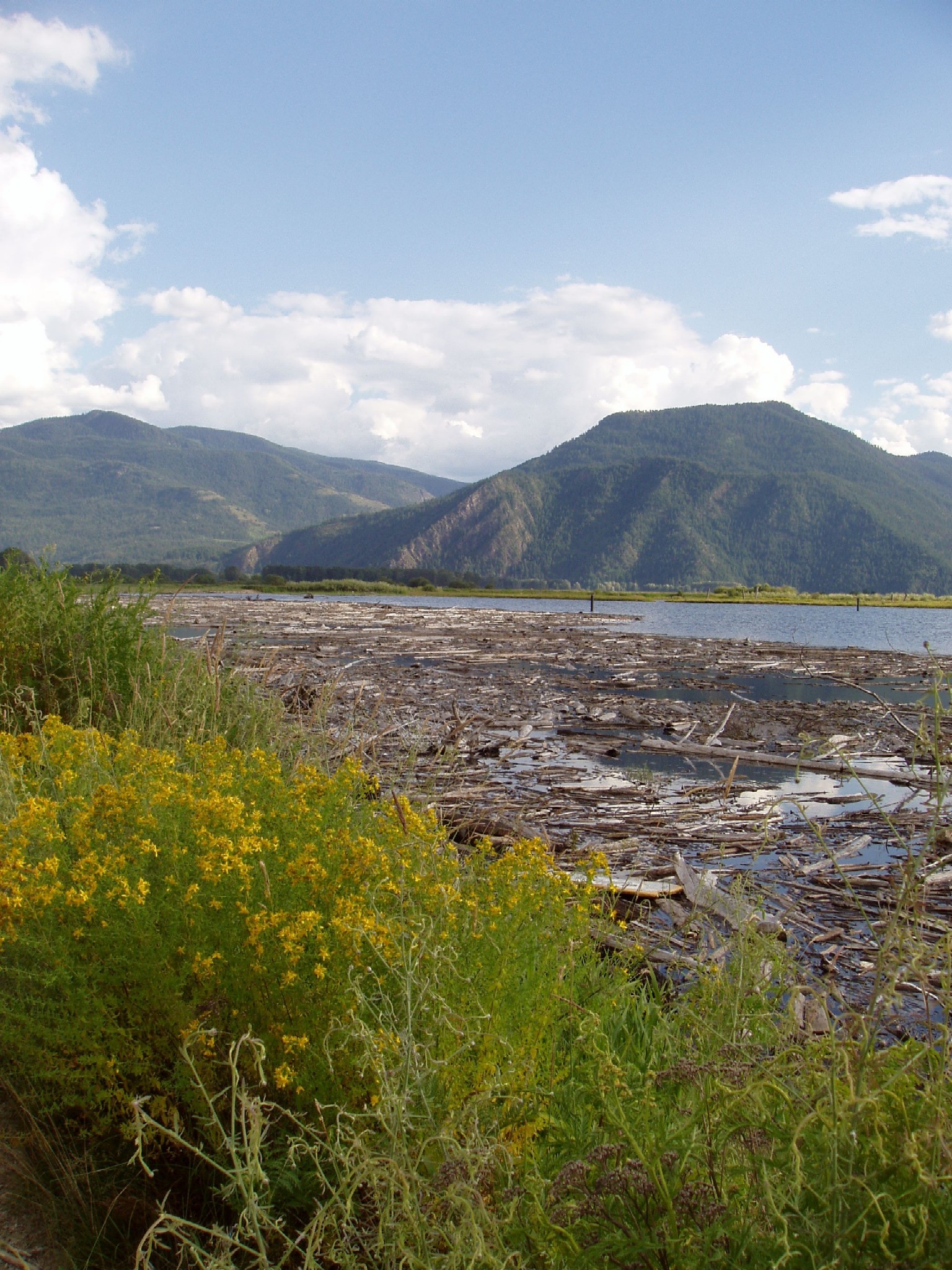
The Corps operates a debris control facility on the Clark Fork river in order to contain and dispose of large volumes of debris flowing down the river each spring. A series of drift control booms are used to channel and contain the debris before it can enter Lake Pend Oreille and become a hazard to navigation. This is referred to as the Clark Fork Drift Yard. The area is currently licensed to Idaho State Department of Fish and Game and offers a boat launch, portable restroom and primitive camping. Camping is limited to three days within any five day period.
|
Facilities
|
Open Year Round
|
|
Campsites
|
|
|
Fees Charged
|
|
|
Picnic Area
|
|
|
Swim Area
|
|
|
Boat Ramp
|
|
|
Restroom
|
|
|
Drinking Water
|
|
|
Roads
|
|
Operated by: Idaho Department of Fish and Game, 2750 Kathleen Ave., Coeur d'Alene, ID, 83814, 208-769-1414 |
Johnson Creek
This primitive camping and access area is eleven miles east of Trestle Creek Day Use Area on State Route 200, and one mile southwest of the town of Clark Fork, ID. The area is currently licensed to the Idaho State Department of Fish and Game. There is a vault toilet but no drinking water. Open year-round. There are no fees for using the area. Camping is limited to three days within any five day period.
|
Facilities
|
Comments
|
|
Campsites
|
|
|
Fees Charged
|
|
|
Picnic Area
|
|
|
Swim Area
|
|
|
Boat Ramp
|
|
|
Restroom
|
|
|
Drinking Water
|
|
|
Roads
|
|
| Operated by: Idaho Department of Fish and Game, 2750 Kathleen Ave., Coeur d'Alene, ID, 83814, 208-769-1414 |
Morton Slough
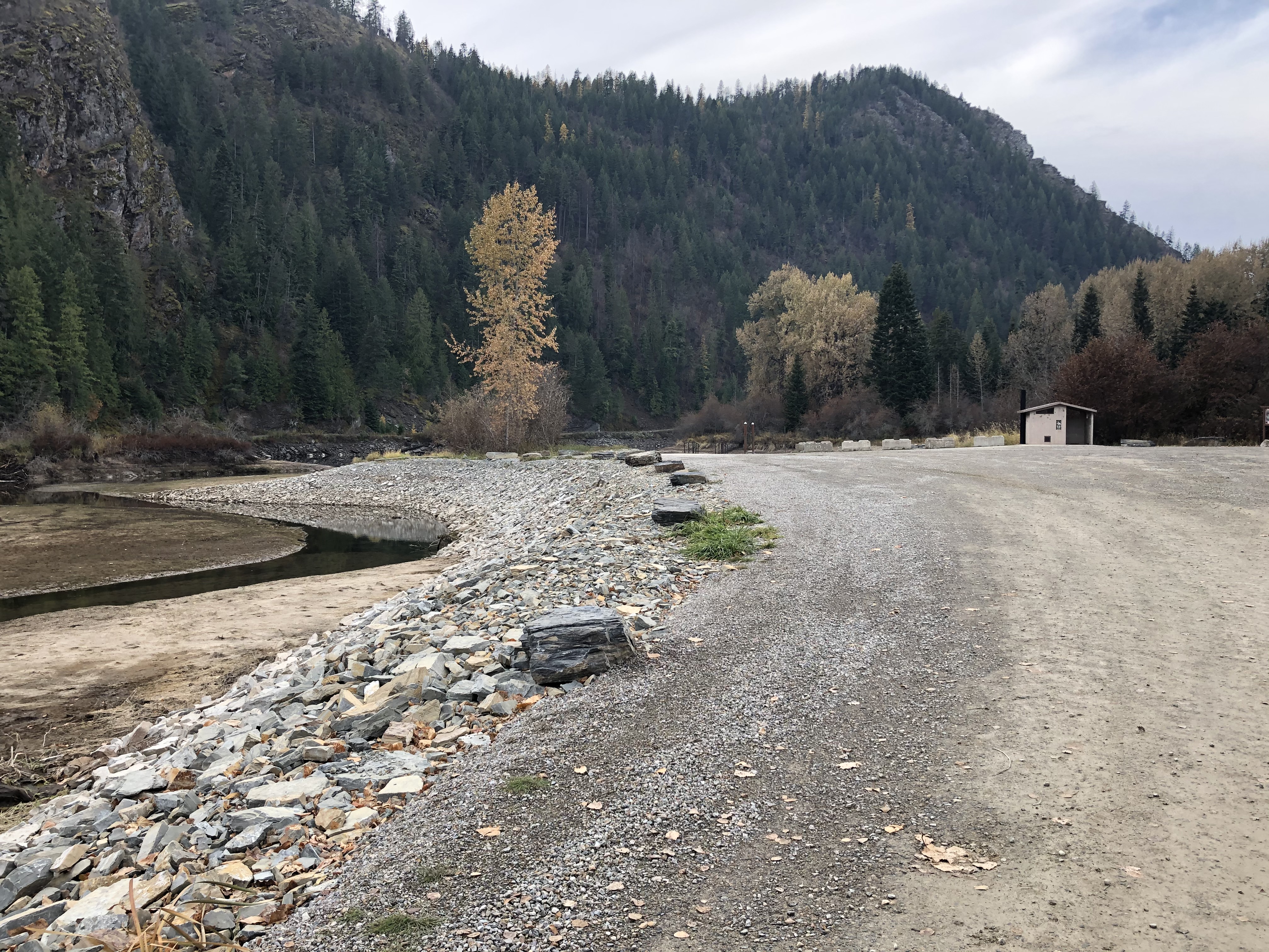
Morton Slough Access Area was built by the Corps of Engineers and is currently licensed to the Idaho State Department of Fish and Game. From Sandpoint, ID, drive south on Highway 95 approximately five miles, and turn west on Dufort Road. The access road to the area is located north of the Dufort-Lakeshore Drive intersection. From Priest River, ID, head south on Merritt's Bridge and turn east on Dufort Road. The intersection is approximately 15 miles east. There is no overnight camping allowed.
|
Facilities
|
Comments
|
|
Campsites
|
|
|
Fees Charged
|
|
|
Picnic Area
|
|
|
Swim Area
|
|
|
Boat Ramp
|
|
|
Restroom
|
|
|
Drinking Water
|
|
|
Roads
|
|
| Operated by: Idaho Department of Fish and Game, 2750 Kathleen Ave., Coeur d'Alene, ID, 83814, 208-769-1414 |
Priest River "The Mudhole"
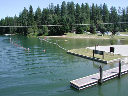
Affectionately called the "Mudhole" by local residents, the Priest River Recreation Area is located one mile east of downtown Priest River, ID, at the confluence of the Priest and Pend Oreille rivers. From the east or west, turn south from Highway 2 at the park entrance signs.
|
Facilities
|
Comments
|
| Open Dates |
- May 18 - September 14 2024 (OPENING IS CURRENTLY DELAYED DUE TO CONSTRUCTION. OPEN DATE TBD).
|
|
Campsites
|
-
20 gravel RV/tent sites with picnic tables and fire rings
-
No hookups
-
Sleeping limit of eight people per site
-
All campsites are 100% reservable and available for same-day reservations
|
|
Fees Charged
|
|
|
Picnic Area
|
- Tables and fire pits available
|
|
Picnic Shelter
|
- Picnic shelter reservation fee: $70 per day. Call Recreation One Stop to reserve or go online at www.recreation.gov
|
|
Swim Area
|
- Designated beach (No lifeguard on duty)
|
|
Boat Ramp
|
- One-lane ramp with fixed pier
|
|
Restrooms
|
- Flush Toilets
- Showers (registered campers only)
- Sinks
- Dishwashing Sinks
- Handicap Accessible
|
|
Playground
|
|
|
Amphitheater
|
- Interpretive Rangers offer campfire programs regularly on summer weekends at 7pm. Call or stop by the Visitor Center, ask a Park Attendant or Park Ranger or look for a program guide at any bulletin board in the campground for more information. Subject to change due to staffing
|
|
Dump Station
|
|
|
Ball Field
|
- Includes a backstop, but bring your own equipment
|
|
Drinking Water
|
|
|
Roads and Parking
|
|
|
Notes
|
-
Check-out time is at 12:00 p.m. on the day of departure
-
Campground reservations may be made through Recreation One Stop by calling 1-877-444-6777. If you are calling from outside the United States, call 1-518-885-3639. Reservations may also be made online at www.recreation.gov
|
Click here for a printable map of the campground
Operated by: U.S. Army Corps of Engineers, Albeni Falls Dam, 2376 E. Highway 2, Oldtown, ID, 83822, 208-437-3133
Riley Creek
Riley Creek Recreation Area is our largest developed overnight facility. Vast lawns and lots of trees gives you the choice of soaking up the sun or relaxing in the shade. There is plenty of space to have a picnic. You can also reserve a picnic shelter for your group event. From the town of Priest River, ID, drive approximately nine miles east on U.S. Highway 2 to the town of Laclede. If you're coming from Sandpoint, the town of Laclede is about 13 miles west on U.S. Highway 2. Turn south on Riley Creek Road at the highway marker signs; the recreation area is one mile in at the end of the road.
|
Facilities
|
Comments
|
| Open Dates |
- May 11 - September 21 2024
|
|
Campsites
|
-
67 gravel RV/tent sites with picnic tables and fire rings
-
Water and electric hook-ups at each site
-
Sleeping limit of eight people per site
-
All campsites are 100% reservable and available for same-day reservations
|
|
Fees Charged
|
-
$35.00 per night per RV/tent site (includes site fee, water and electricity hook-ups, primary camping vehicle and one extra vehicle)
-
No entrance or day-use fees
-
Fees subject to change
-
Click here for fee discount information
|
|
Picnic Area
|
|
|
Picnic Shelters
|
|
|
Swim Area
|
|
|
Boat Ramp
|
|
|
Fishing Piers
|
|
|
Restroom
|
-
Flush Toilets
-
Showers
-
Sinks
-
Dishwashing sinks
-
Handicap Accessible
|
|
Playground
|
|
|
Horseshoe Pits
|
|
|
Volleyball Court
|
|
|
Sport Court
|
|
|
Amphitheater
|
|
|
Dump Station
|
|
|
Boat Basin
|
|
|
Drinking Water
|
|
|
Roads and Parking
|
|
|
Notes
|
-
Check-out time is at 12:00 p.m. on the day of departure
-
Campsite reservations may be made through Recreation One Stop by calling 1-877-444-6777. If you are calling from outside the United States, call 1-518-885-3639. Reservations may also be made online at www.recreation.gov
|
Click here for a printable map of the campground
Operated by: U.S. Army Corps of Engineers, Albeni Falls Dam, 2376 E. Highway 2, Oldtown, ID, 83822, 208-437-3133
Springy Point
Closest to the town of Sandpoint, ID, is the Springy Point Recreation Area. To get here from Sandpoint and U.S. 2, drive south on U.S. Highway 95 across the "long bridge" (you'll understand after you cross it!) Just after the bridge, turn right (west) onto Lakeshore Drive. If you're traveling from Coeur d'Alene, ID, drive north on U.S. Highway 95 about 46 miles, then turn left (west), just before the bridge, onto Lakeshore Drive. Springy Point is almost three miles down the road on the right.
|
Facilities
|
Comments
|
|
Open Dates
|
- May 18 - September 14 2024
|
|
Campsites
|
-
37 gravel RV/tent sites with picnic tables and fire rings
-
No hookups
-
Sleeping limit of eight people per site
-
All campsites are 100% reservable and available for same-day reservations
|
|
Fees Charged
|
-
$25.00 per night per RV/tent site (includes site fee, primary camping vehicle and one extra vehicle)
-
No entrance or day-use fees
-
Fees subject to change
-
Click here for fee discount information
|
|
Picnic Area
|
|
|
Swim Area
|
- Designated beach (No Lifeguard on Duty)
|
|
Boat Ramp
|
|
|
Restrooms
|
|
|
Dump Station
|
|
|
Drinking Water
|
|
|
Roads and Parking
|
|
|
Notes
|
-
Check-out time is at 12:00 p.m. on the day of departure.
-
Interpretive Rangers off campfire programs on summer weekends regularly at 7pm. Call or stop by the Visitor Center, ask a park attendant or park ranger or look for a program guide at any bulletin board in the campground for more information. Subject to change due to staffing.
-
Campsite reservations may be made through Recreation One Stop by calling 1-877-444-6777. If you are calling from outside the United States, call 1-518-885-3639. Reservations may also be made online at www.recreation.gov
|
Click here for a printable map of the campground
| Operated by: U.S. Army Corps of Engineers, Albeni Falls Dam, 2376 E. Highway 2, Oldtown, ID, 83822, 208-437-3133 |
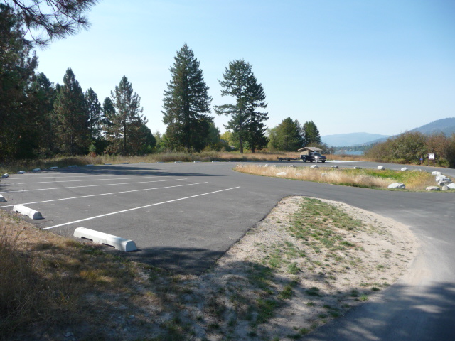
Trestle Creek
Located approximately ten miles east of Sandpoint, ID, near the town of Hope, ID, Trestle Creek Recreation Area is a small day-use only park on the northeast shore of Lake Pend Oreille. From Sandpoint, take Highway 200 east until you see the highway signs for Trestle Creek.
Open: April - October
|
Facilities
|
Comments
|
|
Open Dates
|
|
|
Campsites
|
|
|
Fees Charged
|
|
|
Picnic Area
|
|
|
Swim Area
|
|
|
Boat Ramp
|
|
|
Restroom
|
|
|
Drinking Water
|
|
|
Roads
|
|
| Operated by: U.S. Army Corps of Engineers, Albeni Falls Dam, 2376 E. Highway 2, Oldtown, ID, 83822, 208-437-3133 |
Visitor Center
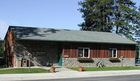
Open: Year-Round
The Albeni Falls Dam Visitor Center is located two miles east of Newport, WA, and five miles west of Priest River, ID, on Highway 2. Here you can overlook the dam, stretch your legs, enjoy your lunch, stroll through the Visitor Center exhibits, and catch a movie. Drinking water, restrooms, maps and brochures are available.
|
Facilities
|
Comments
|
|
Hours
|
- Year Round
- Summer Hours: Seven Days a Week, 7:30 am - 4:00 pm
- Winter Hours: Monday-Friday, 6:30 am - 5:00 pm
- Hours Subject To Change Due to Staffing
- Closed On Off-Season Federal Holidays (October-April)
|
|
Visitor Center
|
-
Interpretive Displays
-
Movie theater
-
Tours of the dam are offered from Memorial Day to Labor Day, Wednesday through Sunday at 1 p.m. and 2 p.m. Tour schedule subject to change due to staffing. Schools and other community groups may schedule tours and interpretive programs by calling the Visitor Center and leaving a message
-
Brochures, maps, area information and activities
-
Chat with a Park Ranger during the summer season (Memorial Day-Labor Day)
|
|
Picnic Area
|
|
|
Restrooms
|
|
|
Pet Area
|
|
|
Drinking Water
|
|
|
Roads
|
|
|
Operated by: U.S. Army Corps of Engineers, Albeni Falls Dam, 2376 E. Highway 2, Oldtown, ID, 83822, 208-437-3133
The Mission of the Natural Resource Section of the Albeni Falls Dam is to provide recreation, natural resource management, emergency services and public education and information that improves the quality of life for visitors to our facilities and the general public through a trained, customer oriented, professional staff.